Basic UAV Mapping
In the present context, Unmanned Aerial Vehicle (UAV) mapping provides unprecedented advantages over the traditional survey. The use of drones in surveying upgrades the quality of data being received. UAV mapping is a better way to map an area than aerial mapping or satellite imagery. It has advantages such as low cost, high frequency of updates, quick deployment, and completion time.
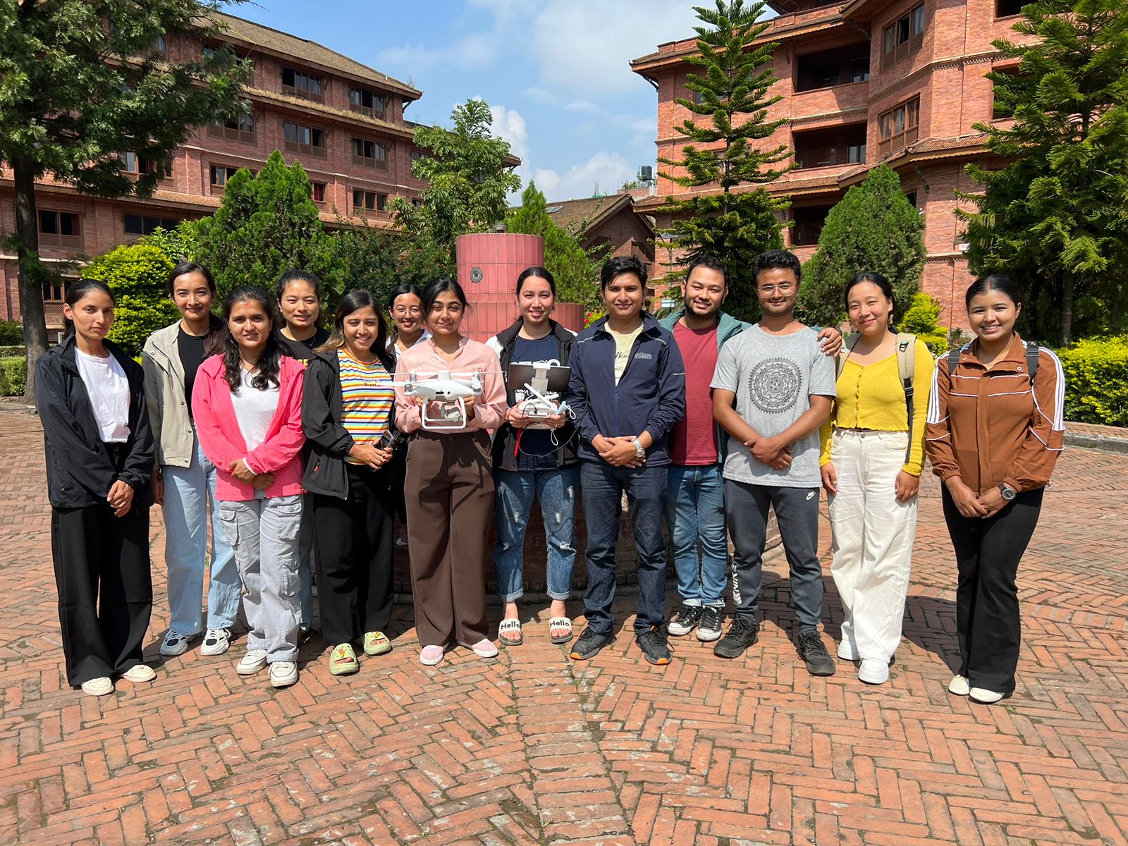
This tutorial is based on the drone training provided to 4th Semester students from Masters of Environmental Science, Khwopa College, Bhaktapur. Let’s dive into the training materials:
Introduction
The drone used in the training is the DJI Phantom 4 MULTISPECTRAL. The P4 Multispectral streamlines the gathering of data that provides insights into crop health and vegetation management. This allows us to capture agricultural imagery more effectively than ever before. With an integrated stabilized imaging system that gathers comprehensive data sets, we can collect data using one RGB camera and a multispectral camera array with five cameras covering Blue, Green, Red Edge, and Near Infrared bands - all at 2 MP with a global shutter, on a three-axis stabilized gimbal. This makes data collection more efficient and precise.
Drone parts
- Propeller
- Multispectral Camera
- Gimbal
- Remote Controller
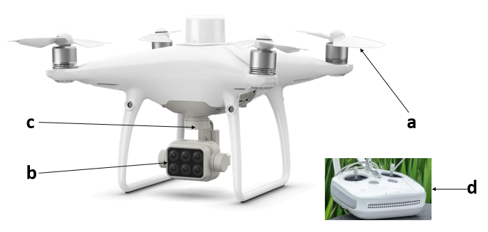
Image Capture
Capturing the image is an essential step in the UAV mapping. Drone pilots must pay special attention during the capturing phase as it affects the results. The image capture involves the following steps:
-
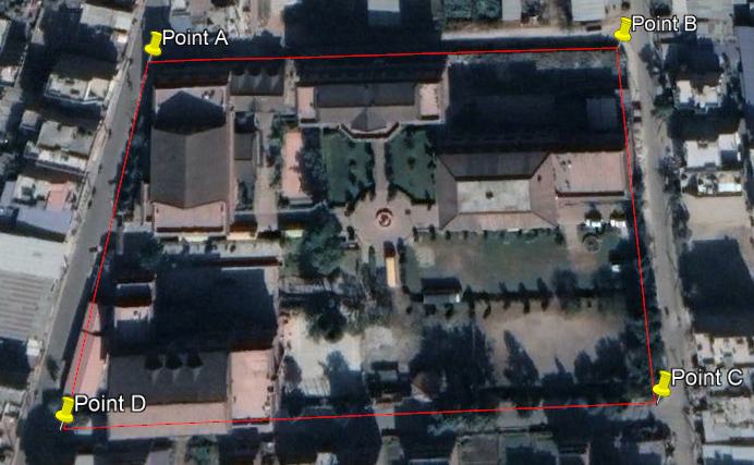
Office Planning
-
Planning of Flight Path
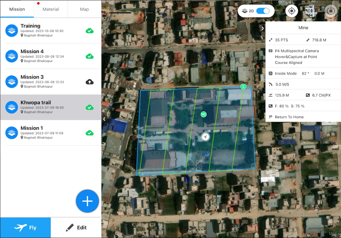
-
Image capture using drone
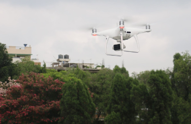
Image Processing
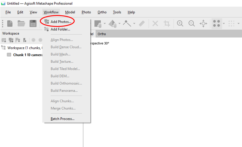
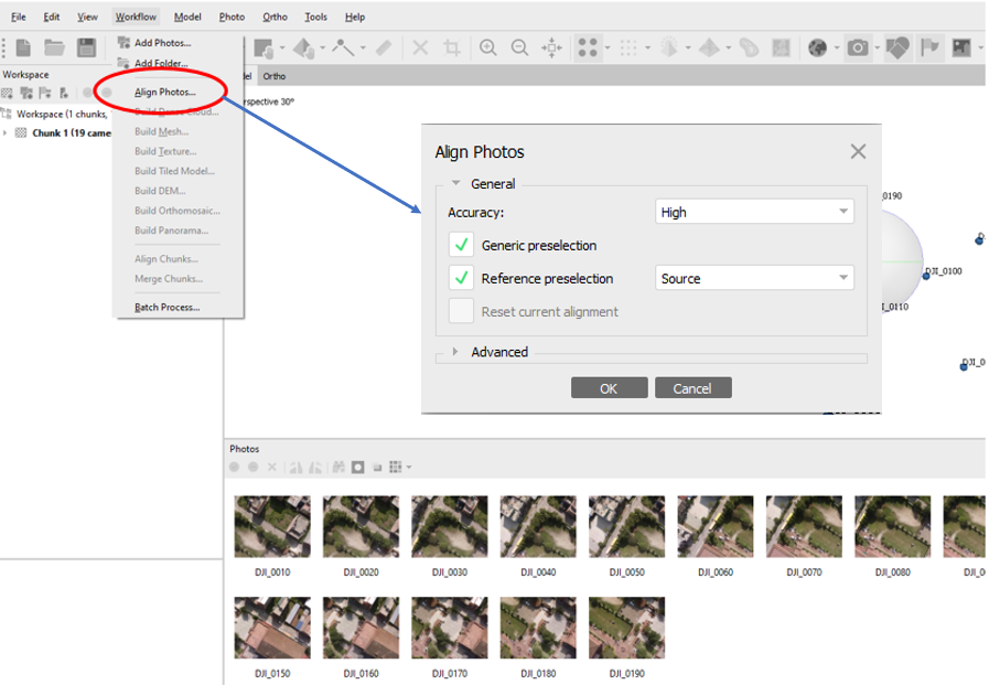
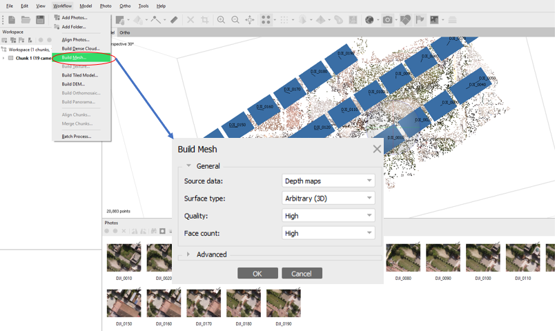
With the completion of image capture, drone mapping follows the processing of images using software. Commercially, multiple software like PIX4D, Metashape, Dronedeploy, and Global Mapper can be utilized to process the image. In this tutorial, we follow the image processing steps using Agisoft Metashape.
-
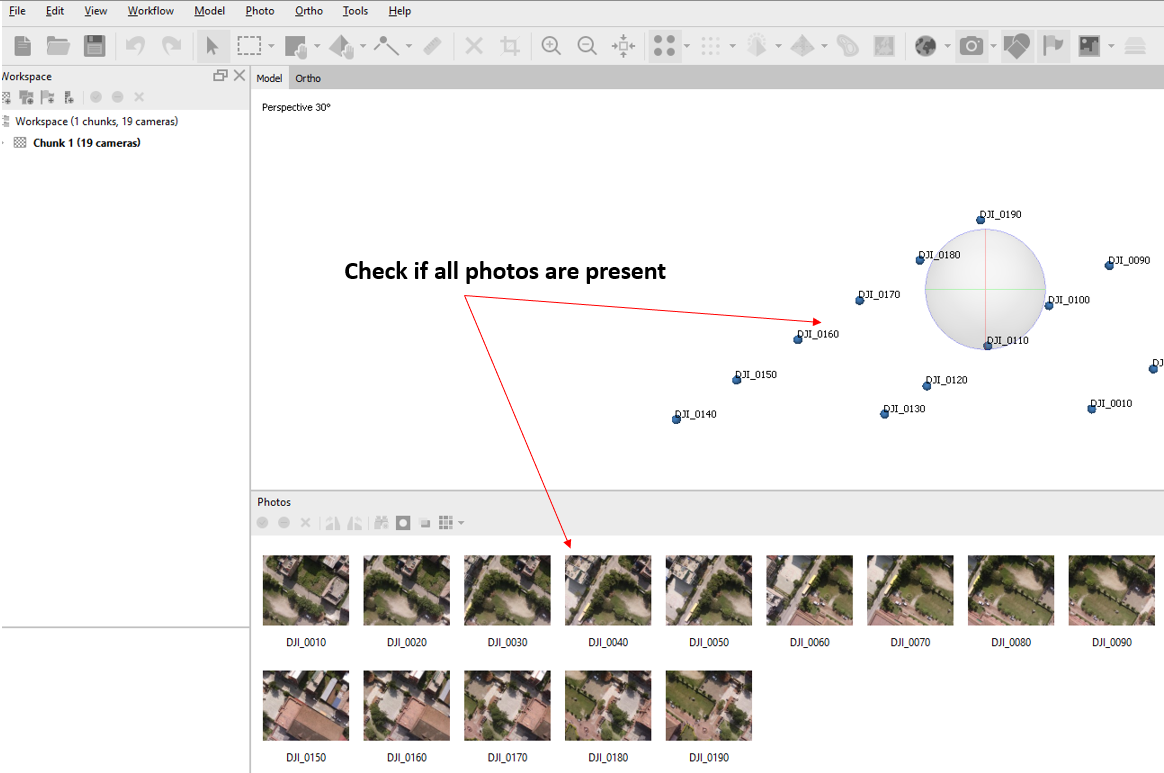
Importing images into Metashape
-
Align images
-
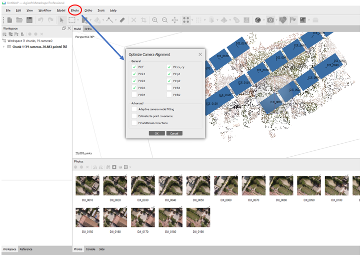
Optimize camera alignment
-
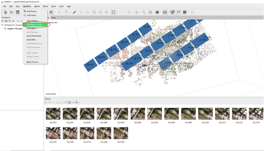
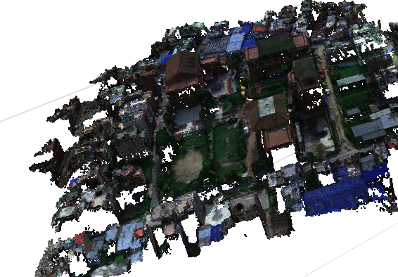
Build dense cloud
-
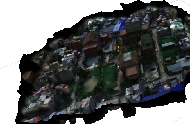
Build mesh and texture
-
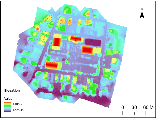
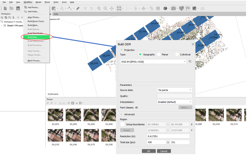
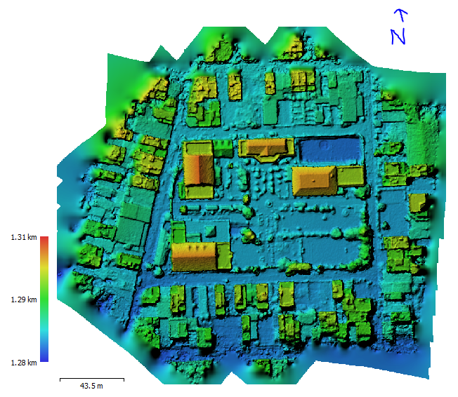
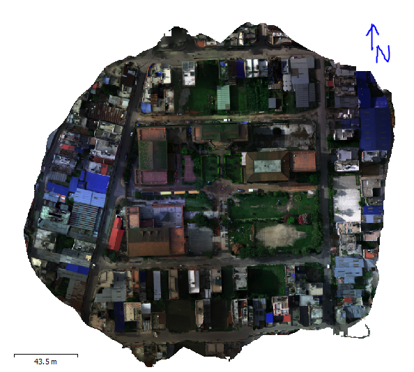
Generate orthophoto and DEM
-
Visualization in GIS